


Recent field data and geographical documentation have revealed a transformation of what Israel describes as 'buffer security zones' in the Gaza Strip, southern Lebanon, and Syria from temporary lines into vast areas of occupation and military influence. The areas currently under direct Israeli control or military influence exceed 1100 square kilometers, indicating a strategy to establish permanent security belts that vary between combat positioning, field control, and imposing movement restrictions.
The occupation authorities justify this expansion on security grounds. Israeli Security Minister Yisrael Katz announced in April 2025 that the army would not withdraw from areas it designated as 'safe' in the Gaza Strip, even if future settlements are reached. This approach also extends to the northern front, where Israel has maintained military positions in southern Lebanon despite ceasefire agreements, considering them part of a new buffer zone.
In southern Lebanon, geographical matching operations of recently published visual materials showed that Israeli movements have expanded to include a wide network of strategic military positions. Field sources documented the construction of a bridge over the Litani River, in addition to observing vehicles and forces inside the town of Taybeh, reflecting a desire to establish strongholds that go beyond the traditional Blue Line.
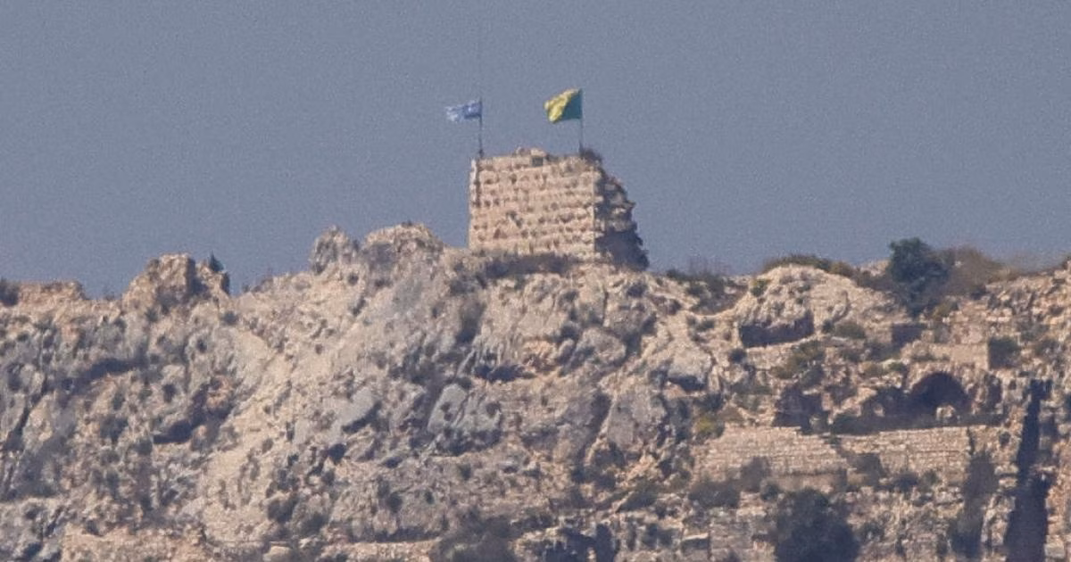
Among the most prominent Israeli strongholds in Lebanon is the historic Beaufort Castle, where investigations confirmed the presence of occupation forces inside it, about five kilometers from the border. The Israeli Security Minister explicitly stated that forces would remain in this strategic castle as part of what he described as the new security zone, to ensure field superiority in the eastern sector.
Estimates based on geographical measurement tools indicate that the area of Israeli occupation or military influence in southern Lebanon has reached approximately 625 square kilometers. This area represents about 6% of the total Lebanese territory, most of which is located within areas that have been subjected to repeated evacuation orders and intensive shelling, leading to widespread destruction of infrastructure.
In the Gaza Strip, the pattern appears similar in terms of seeking to impose a new geographical reality by expanding the 'Yellow Line'. Despite many months passing since previous understandings, Israeli Prime Minister Benjamin Netanyahu announced last May an increase in the percentage of land included in the buffer zone to reach 70% of the total area of the Strip.
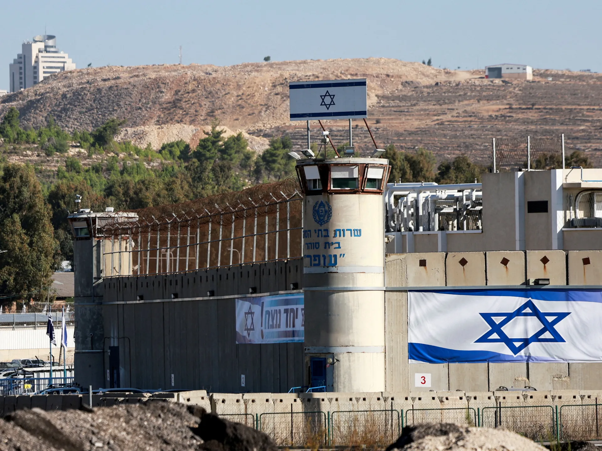
Map analysis results showed that only about one-third of the Gaza Strip's area is currently outside the scope of direct ground occupation or declared areas of influence. The area under direct military control is estimated at approximately 425 square kilometers, with forces deployed in strategic axes that divide the Strip and control its vital joints.
On the Syrian front, the Israeli army exploited field developments and the fall of the regime in December 2024 to move quickly and cross the lines of the 1974 disengagement agreement. Israeli forces controlled the former buffer zone before expanding their deployment to deeper positions in the Quneitra and Daraa governorates, reaching the vicinity of the strategic Mount Hermon.
Mount Hermon holds exceptional importance in Israeli security doctrine, with Yisrael Katz announcing in early 2025 that the army would remain in the area and around the mountain indefinitely. This presence is accompanied by the establishment of permanent military sites, supply routes, and advanced observation points overlooking vast areas of the Syrian interior.
Satellite images detected the construction of new logistical sites north of the separation line near Majdal Shams, where forces are positioned more than two kilometers deep inside Syrian territory. The expansion also included the towns of Jubata al-Khashab, Hamidiya, Quneitra, and Qahtaniya, where Israeli military vehicles were seen moving freely in those areas.
The area of Israeli military influence in southern Syria is estimated at approximately 235 square kilometers, an area not entirely under permanent infantry control but under fire control and surveillance. Within this area, Israel manages fixed positions and military roads that ensure rapid intervention when necessary, effectively turning it into a sphere of influence.
This field expansion coincides with political pressure and Israeli demands for disarmament in the three southern Syrian governorates: Quneitra, Daraa, and Sweida. Experts believe that this security concept aims to create a security belt that practically extends to the road connecting Damascus and Sweida, which places vast areas under direct military threat.
These security belts imposed by Israel on the three fronts reflect a shift in military strategy from 'border defense' to 'preventive occupation'. By seizing land and establishing facts on the ground, Israel seeks to impose its terms in any future negotiations, relying on geographical control that makes a return to pre-conflict borders complicated.
In conclusion, updated maps show that Israel has succeeded in carving out strategic areas from neighboring countries and the Gaza Strip under the guise of buffer zones. With the continued construction of logistical facilities and military roads, these areas appear likely to remain as long-term spheres of influence, radically changing the geopolitical map of the region.
The army will not withdraw from the so-called 'safe areas' in the Gaza Strip even after any future settlement is reached.


Share your opinion
Maps of Israeli Expansion: Security Belts and Spheres of Influence Devour 1100 sq km in Gaza, Lebanon, and Syria